
Click the picture above to enter our online bidding platform!
Baker Farm Auction – Bureau County, IL
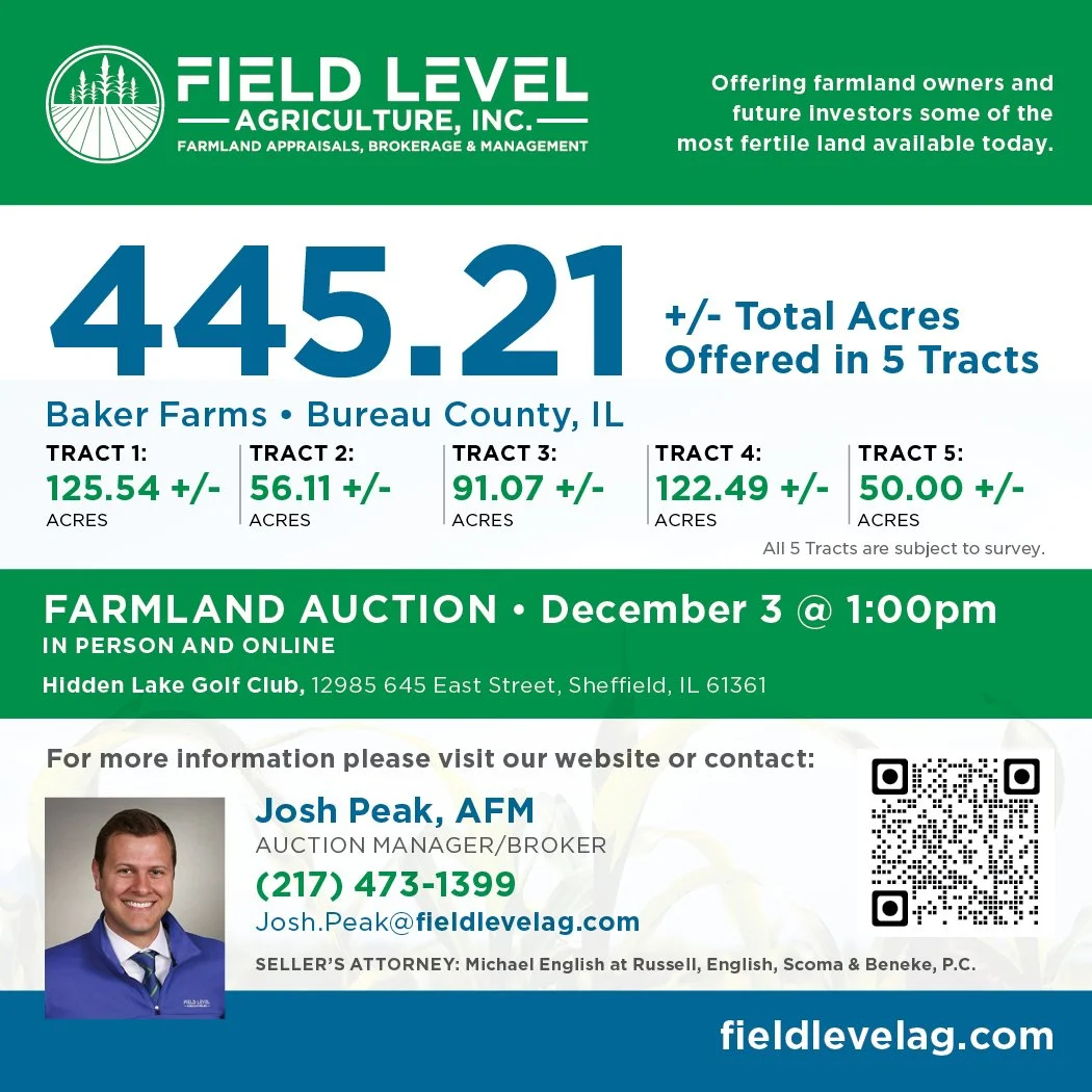
For Sale: 445.21 +/- Acres in 5 Tracts via “Buyers’ Choice and Privilege” format. Subject to Survey. Acres will be announced day of auction.
Online Bidding Available
Auction Date: Thursday, December 3rd at 1:00pm
Hidden Lake Golf Club, 12985 645 East St. Sheffield, IL 61361
Field Level Agriculture, Inc. is pleased to offer 445.21 +/- acres subject to survey via public auction on December 3rd at 1:00 p.m. The property will be offered as five separate tracts. All 5 tracts will be sold via surveyed acres which will be announced the day of the auction. Tract 1 – 125.54 +/- acres, Tract 2 – 56.11 +/- acres, Tract 3 – 91.07 +/- acres, Tract 4 – 122.49 +/- acres, Tract 5 – 50.00 +/- acres. Tracts 1, 2, 4, and 5 have public road access. Tract 3 has access from the south through a 50 foot easement across Tract 4 as well as access from the north via an easement off County Rd 1200 N. This auction will be held at Hidden Lake Golf Club, 12985 645 East St. Sheffield, IL 61361 with an online bidding option.
CLICK HERE TO ENTER OUR ONLINE BIDDING PLATFORM.
Download the Brochure HERE.
For additional information on this auction offering, please contact Auction Manager / Broker, Logan Frye at 217-619-6473.
Tract Details
Tract 1: 125.54 +/- Acres (Subject to Survey) Taxes: $39.13/acre (Estimated Prorated amount from split of other PIN #’s) Estimated Tillable Acres: 100.07 ac. 128.2 PI Rating
Tract 2: 56.11 +/- Acres (Subject to Survey) Taxes: $41.75/acre (Estimated Prorated amount from split of other PIN #’s) Estimated Tillable Acres: 52.48 ac. 129.3 PI Rating
Tract 3: 91.07 +/- Acres (Subject to Survey) Taxes: $44.27/acre (Estimated Prorated amount from split of other PIN #’s) Estimated Tillable Acres: 81.51 ac. 110.9 PI Rating
Tract 4: 122.49 +/- Acres (Subject to Survey) Taxes: $43.82/acre (Estimated amount from split of PIN #) Estimated Tillable Acres: 122.49 ac. 135.9 PI Rating
Tract 5: 50.00 +/- Acres (Subject to Survey) Taxes: $43.82/acre (Estimated amount from split of PIN #) Estimated Tillable Acres: 50.00 ac. 134.9 PI Rating
Auction Details
Procedure of Sale: The method of sale for this auction offering will be the “Buyers Choice and Privilege” format. The winning bidder will have the right to select any tract or combination of tracts after the first round of bidding has concluded. Those tracts not selected by the winning bidder will be offered to the runner-up bidder at the winning bid price. At that time, any tracts not selected will be offered via a new round of bidding, and the process will be repeated until all tracts have been selected. Tracts will not be available after selection – this is not a multi-parcel combination auction. Bidding will be on a per acre basis, with the winning bid multiplied by the announced acreage to determine the contract price. Final acres will be announced on the day of sale.
Down Payment: Upon acceptance of an offer, the buyer shall be required to enter into a written purchase agreement and submit 10% earnest money by personal check, cashier’s check or bank wire.
Closing: January 15th, 2027 at Russell, English, Scoma & Beneke, P.C. Ten Park Ave. West, Princeton, IL 61356
Real Estate Taxes: Buyer will receive a credit at closing for the 2026 real estate taxes payable in 2027, based on the most ascertainable figures. The buyer shall then be responsible for payment of said taxes.
Possession: Possession will be granted at closing, subject to the tenant in possession. The farm lease is open for the 2027 crop year. Access will be granted after the 10% earnest money is received for the buyer or buyer’s tenant to make preparations for the 2027 crop.
Minerals: The owner’s interest in any mineral rights, if any, will be included with the sale of the property.
Easements: This property sells subject to any and all easements of record and they will be conveyed with the property.
Reimbursements Due: There are no reimbursements due as part of this transaction.
Survey: All tracts will be sold based on surveyed acres that will be announced the day of the auction. The survey will be completed by Wallace Land Surveying out of Toulon, IL.
Agency: Field Level Agriculture, Inc., its brokers and representatives, are agents of the Sellers only. • Josh Peak, Auction Manager/Broker • Seth Baker, Managing Broker • Alex Head, Auctioneer.
Disclaimer: The information in this brochure is considered to be accurate, however, the information is subject to verification. No liability for errors or omissions is assumed. The property is being sold on an “AS IS, WHERE IS, WITH ALL FAULTS” basis, and no warranty or representation, either express or implied, concerning the property is made by either the Seller or Field Level Agriculture, Inc. The information contained in the supporting literature is believed to be accurate but is subject to verification by all parties relying on it. No liability for its accuracy, errors or omissions is assumed by the Seller or Field Level Agriculture, Inc. Each potential buyer is responsible for conducting its own independent inspections, investigations, and all due diligence concerning the property and do so at their own risk. Neither the Seller nor Field Level Agriculture, Inc. are warranting and specific zoning classification, location of utilities, nor warranting or representing as to fitness for a particular use access, or physical or environmental condition. Diagrams and dimensions in the marketing literature are approximate. All information contained in any related materials are subject to the terms and conditions of sale outlined in the purchase contract. Announcements made over online bidding platform and on the day of the sale take precedence over all printed material.

Drone image of Tract 1 of the Raychris, Inc. Farm from the southeast looking northwest.

Drone image of Tract 3 of the Raychris, Inc. Farm from the southeastlooking northwest.

Drone image of Tract 5 of the Raychris, Inc. Farm from the northeast looking southwest.

Drone image of Tract 7 of the Raychris, Inc. Farm from the southeast looking northwest.

Drone image of Tract 9 of the Raychris, Inc. Farm from the northeast looking southwest.

Drone image of Tract 11 of the Raychris, Inc. Farm from the southeast looking northwest.

Drone image of Tract 2 of the Raychris, Inc. Farm from the northwest looking southeast.

Drone image of Tract 4 of the Raychris, Inc. Farm Farm from thenortheast looking southwest.

Drone image of Tract 6 of the Raychris, Inc. Farm from the southeast looking northwest.

Drone image of Tract 8 of the Raychris, Inc. Farm from the southeast looking northwest.

Drone image of Tract 10 of the Raychris, Inc. Farm from the southeast looking northwest.

Drone image of Tract 12 of the Raychris, Inc. Farm from the northwest looking southeast.